Nebraska Regional CGA Underway!
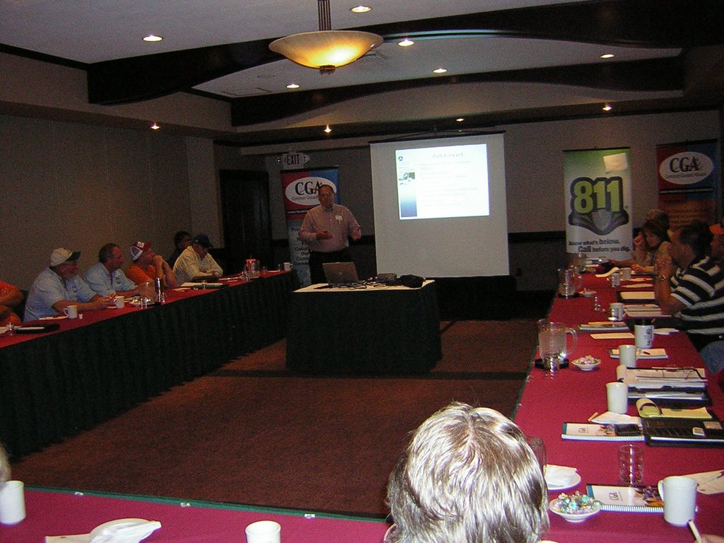
The first Nebraska Regional Common Ground Alliance meeting was held Wednesday, October 18 at the Regency Lodge in Omaha.
An overview of the Common Ground Alliance and Regional Partnerships was presented by Perly Schoville and Mike Shallow with Union Pacific, Dan Maschka with Northern Natural Gas and Harold Winnie from the Department of Transportation, Kansas City.
Following the presentations, the floor was opened up to all present for a round-table discussion focusing upon regional and industry issues involving underground facilities. From these discussions, specific areas of focus were identified as was the need to further pursue an alliance on a regional basis.
Approximately 35 individuals from across the state attended the meeting. Industries represented included: Union Pacific Railroad, Nebraska Department of Roads, Department of Transportation, Northern Natural Gas, NEBCON, Inc., General Excavating, Kinder Morgan, OPPD, City of Omaha, Glenwood Telephone, ELM Locating, Nebraska State Fire Marshal’s Office, K2 Construction, Aquila, Enterprise Products, Nebraska City Utilities and M.U.D. The event was hosted by Consolidated Utility Services Inc./Nebraska Digger’s Hotline.
The next Regional CGA meeting will be held in Lincoln during the week of November 27. This meeting will be hosted by Jeff Stoolman with Enterprise Products. The meeting is open to anyone interested in participating in the Common Ground Alliance. For further information regarding the Nebraska Regional CGA, please contact Susan Griess at 402-778-3024 - susan.griess@cusinc.com.
The Common Ground Alliance is a National Organization with the mission to ensure public safety, environmental protection, and integration of services by promoting effective damage prevention practices.
If you would like further information regarding the Common Ground Alliance, please visit their website at www.commongroundalliance.com.
Wednesday, October 18, 2006
Friday, October 13, 2006
Mash Ups and One Call
Mash Ups and One Call
Every one-call center has an amalgamated GIS/work order management system that it uses to receive and transmit locate requests. AGTI’s IRTH platform is an industry leader, but there are a number of others (OCC’s Prism, Norfield, TelDig come to mind immediately) that have their fans.
These systems require a lot of care and feeding. Core GIS base maps, updated utility records and tolerance zones, heavy hardware investments and 24/7/365 call center staffs to name a few elements. And all of that investment results in…a static text based work order that someone has to interpret and which only references the pertinent utility and GIS data required to support the overall damage prevention effort, and effort which is as dynamic and 3-D an environment as you can get without involving a UN peace-keeping force.
Is there a better way?
Probably.
The gentleman who submitted this note and the staff of Direction Magazine have some interesting and ambitious ideas.
Bob Gaspirc, OLS, CLS, OLIP, WES-Tech Services, Ontario, CanadaNotes from undergroundI would like:
· Firm and clear data standards that describe the objects to be collected and why they need to be collected.
· Harmonization of best business practices focused on underground infrastructure damage prevention
· More frequent "one-call" services to locate and designate the existence of utilities during all phases, (from permitting , design, construction and as-built)
· Technologies and tools that enable all underground facilities to be locatable. New cheaper technologies and methodologies are required to ensure that the presence and type of underground facilities are readily locatable, and may be identified through such devices such as tonable pipes, cables, tracer wire, locator balls etc...AND perhaps legislation, or city by-laws that may include permanent above and or below ground markers.
· Technologies that would be used by contractors to mark out the as-laid, as-construct, and as-found utilities.
I would like to see the further development of technologies such as hand-held units that measure, G.P.S.xyz at the station, laser distance range to "reflector less" points on an exposed utility, built in compass, built in inclinometer, and oh yeah, at least a 3 megapixel embedded camera with a display screen on which standard pull-down menus can be easily used by backhoe operators, inspectors, or construction supervisors to identify the object, type, and location under the ground "¦ all for under "¦ $5,000.
http://www.directionsmag.com/editorials.php?article_id=2069&trv=1 (full article with editorial opinions and predictions from the Direction staff)
Is it available today? Maybe. The next link provides some IT strategy and technical perspective on the current state of the emerging public domain GIS toolset and the yin to its yang, location-based services.
“Why CIOs need to know about Ajax and mash-ups”
http://management.silicon.com/itdirector/0,39024673,39161297,00.htm
Too techie? Okay, here’s a city planner (okay, a California-based city planning student, but still) who is talking about the same stuff in words that don’t require translation by your My Space obsessed teenager.
‘Mash-Ups’ Will Revolutionize How Planners and Citizens View City Planning’
http://www.planningreport.com/tpr/?module=displaystory&story_id=1190&format=html
Are AGTI and the other one-call system vendors working on this stuff? I don’t know. Should they be? Absolutely, if they are interested in truly developing and supporting a process that everyone in the utility service industry can use, understand and afford…and not locking people into licensing and support for their specific platforms.
Subscribe to:
Posts (Atom)
